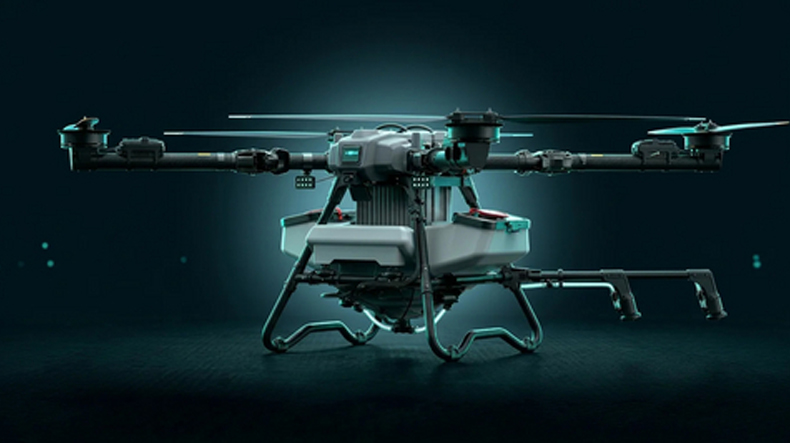
SINGAPORE--(BUSINESS WIRE)-- DroneDash Technologies and GEODNET, the world’s largest decentralized GNSS-RTK network, have announced the formation of GEODASH Aerosystems, a Singapore-based joint venture focused on developing next-generation AI-powered agricultural spraying drones for large-scale farming operations.
The new platform is designed specifically for industrial agriculture sectors such as oil palm, sugarcane, soybean, and broad-acre farming across Southeast Asia, the United States, and South America. Commercial deployment is expected to begin in Q3 2026.
Unlike traditional agricultural drones that depend on repeated manual field mapping before each mission, GEODASH Aerosystems combines real-time AI vision technology with centimetre-level RTK positioning to enable fully dynamic flight operations. The system can perceive terrain, canopy structures, and operational zones during flight, eliminating the need for repeated pre-mapping and manual survey work.
This AI-driven architecture addresses major operational limitations faced by conventional agriculture drones, especially in large plantation environments where terrain conditions, planting layouts, and canopy profiles frequently change. Traditional workflows often require time-consuming remapping whenever fields are replanted, pruned, or affected by erosion, reducing efficiency and slowing deployment speed.
By integrating DroneDash’s proprietary AI Vision system with GEODNET’s precision RTK correction network, the new drone platform enables:
The drones also maintain built-in geofencing, operational safety controls, and detailed flight data logging to support regulatory compliance and operational traceability.
Beyond spraying, the system functions as a complete aerial agronomic intelligence platform. Every flight collects operational and environmental data that is processed through DroneDash’s AI Smart Farming backend. This allows plantation managers and agronomy teams to access advanced insights such as canopy density analysis, crop stress detection, spray validation, drainage profiling, and long-term field performance trends.
The backend analytics platform is designed to help operators identify pest outbreaks, nutrient deficiencies, and underperforming crop zones earlier while optimizing spray schedules, fertilizer planning, and resource allocation.
Paul Yam, CEO of DroneDash Technologies and GEODASH Aerosystems, said modern agriculture requires smarter autonomous systems rather than simply larger drones. He explained that removing manual mapping and integrating AI-powered analytics transforms spraying drones into intelligent operational tools that also support strategic agronomic decision-making.
Mike Horton, Founder of GEODNET and Co-Founder of GEODASH Aerosystems, stated that combining centimetre-level RTK precision with real-time AI perception creates a highly reliable autonomous agriculture platform capable of supporting both operational accuracy and data-driven farm management.
Pilot deployments and system validation programs were carried out throughout 2025 and early 2026 in collaboration with plantation operators. The companies are now preparing for commercial rollout pending final manufacturing readiness and regulatory approvals.
DroneDash Technologies develops autonomous drone systems, AI-enabled Smart Farming platforms, and precision agriculture solutions designed for large-scale agricultural and plantation operations.
GEODNET operates the world’s largest decentralized GNSS-RTK network, providing centimetre-level positioning accuracy for autonomous systems, precision agriculture, surveying, and physical AI applications at global scale.
.jpeg)