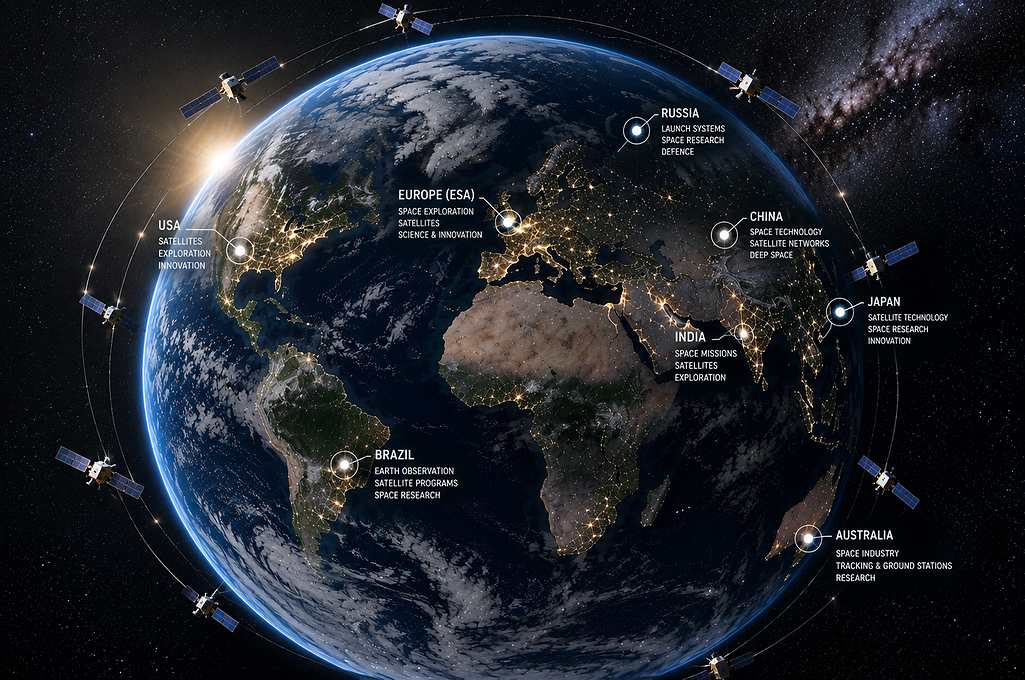
A private satellite can photograph almost anywhere on Earth. But whether the rest of us ever see that photo often depends less on the company that owns the camera than on a decision made in Washington. That’s the paradox sitting at the center of a rapidly expanding segment of the commercial space economy. The events of 2025 and 2026 have made that dependency harder to ignore.
Global Market Insights estimates the commercial Earth observation satellite market was worth $4.7 billion in 2025 and will reach $11.4 billion by 2035, growing at a 9.2% compound annual rate.. Other trackers place current revenue closer to $4 billion to $5 billion, with growth nearer 15%, powered by cheaper launches, sharper sensors, and analytics platforms that convert raw pixels into tradable intelligence. On paper, it looks like a straightforward growth story. In practice, it is a business built on borrowed authority, and 2025 was the year that fact became impossible to overlook.
From government-dominated imagery to a commercial market
For decades, Earth observation belonged almost exclusively to national intelligence agencies, funded through classified budgets and shielded from public scrutiny. That began to change, as small satellite constellations got cheaper to build and launch, opening the field to private operators. What was once dominated by a handful of prime contractors- GeoEye, DigitalGlobe, SPOT, is now a crowded field of dozens of companies flying optical, radar, hyperspectral, and radio frequency sensors, all competing to sell data and turn it into actionable intelligence.
The customer base has broadened along with the technology. Precision agriculture, insurance underwriting, supply-chain Analytics, climate monitoring, and defense contracting are now all buyers of the same underlying data, and that diversification is a large part of why investors find the sector attractive. The commercial Earth-observation industry may be diversifying its customers, but major U.S. operators remain meaningfully tied to government demand.
Planet Labs, Vantor, and BlackSky are among the U.S.-based companies competing in commercial Earth observation and spatial intelligence. Vantor is the former Maxar Intelligence business, which was rebranded in October 2025. That single point of dependency is what turns an otherwise clean growth story into a governance risk that market expansion alone can't solve.
One government, one switch
Every US remote sensing license carries a provision few people outside the industry have ever heard of: shutter control. The risk isn't that Washington routinely turns satellites off. It is that U.S. commercial remote-sensing companies operate within a regulatory system that gives the government significant authority over the collection and distribution of sensitive imagery, while recent geopolitical events have demonstrated how access can be restricted in practice.
Under authority dating back to a 1994 presidential directive, the Secretary of Commerce, after consulting with the Secretaries of Defense and State, can order a licensed company to limit what it collects or distributes whenever national security or foreign policy is judged to be at stake. This is not a theoretical risk. In March 2025, the U.S. government temporarily suspended Ukrainian access to the Global Enhanced GEOINT Delivery system, a government platform providing access to U.S.-purchased commercial imagery. Maxar disabled access to that platform while saying other customer programs were unaffected.
Access was restored about a week later, once the political calculus shifted again. This spring, Planet Labs began withholding high-resolution imagery of Iran from its public platform at the government's request, granting access only on a case-by-case basis for what it called "mission-critical" needs. During the Gaza war in 2023, Planet and other providers also restricted, delayed or changed how some imagery was distributed, although the companies continued supplying imagery through other channels. Yale's Nathaniel Raymond, who studies the industry closely, calls this pattern "business as usual" rather than an aberration.
For a public or soon-to-be-public company, that is a material risk that rarely appears in annual reports: a core revenue stream that a single government office can throttle overnight, with little warning and little recourse for the customers on the other end.
Why customers are starting to hedge
Sophisticated buyers have become more discerning, and they are driving demand in the industry. Governments that once relied on US imagery are viewing it more as a strategic weakness than a convenient purchasing option. Analysts believe these restrictions will lead to a shift toward non-US vendors, which poses a competitive threat to American operators, even as the overall market grows larger.
The disruption has also strengthened the case for sovereign satellite capabilities among governments that do not want critical geospatial intelligence to depend on another country's commercial or regulatory decisions. Ukraine has already made the move, creating its own Space Policy Directorate, to develop a sovereign satellite capability by 2030. Expect similar efforts to accelerate in defense budgets in Europe and Asia in the years ahead, as governments seek to reduce their reliance on a foreign supplier's license.
That shift also creates an opportunity hiding inside the risk: sovereign-constellation programs translate into new contracts for launch providers, satellite manufacturers, and ground-systems vendors, even as they chip away at the market share of the established US imagery companies specifically.
A regulatory ceiling that moves with the competition
A second constraint is worth flagging for anyone underwriting this sector: resolution limits. U.S. imagery restrictions have historically been influenced by what foreign competitors can already sell. That ceiling has never been fixed by principle so much as by competitive pressure. In 2020, Washington eased restrictions on imagery of Israel specifically because European and South Korean firms were already selling sharper pictures of the same territory. The Israel case shows that U.S. restrictions can be adjusted when comparable imagery becomes commercially available from foreign providers, creating a regulatory framework that must account for the capabilities of competitors outside U.S. jurisdiction.
The technology is also becoming more diverse. Synthetic-aperture radar can produce imagery through clouds and at night, while hyperspectral sensors capture information across wavelengths that can reveal characteristics invisible to conventional optical cameras. As commercial capabilities become more sophisticated, regulators face a harder task in distinguishing ordinary commercial remote sensing from data with clear national-security implications.
The relationship is not simply regulatory. It is commercial. U.S. government agencies are major buyers of commercial satellite imagery, creating an unusual dependency in which the state can simultaneously regulate the companies, purchase their data and influence how that data is distributed during sensitive conflicts.
The bottom line
The commercial Earth-observation market is still expanding, but its independence has limits. Companies can build constellations, sell subscriptions and develop increasingly sophisticated analytics, yet their operations remain tied to licensing rules, government contracts and national-security decisions. The market's next phase may therefore depend on more than better sensors and cheaper launches. It may also depend on whether customers believe commercial satellite data will remain available when geopolitical pressure is at its highest.